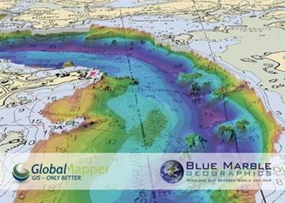
Blue Marble Global Mapper 21.1.0
Blue Marble Global Mapper 21.1.0 | 455.3 mb
Blue Marble Geographics is pleased to announce the immediate availability of Global Mapper version 21.1. Equally well suited as a standalone spatial data management tool and as an integral component of an enterprise-wide GIS, Global Mapper is a must-have for anyone who works with maps or spatial data.
Recent Developments in Global Mapper
For more than twenty years, Global Mapper's development has depended on direct interaction with users and most of the major functional enhancements can be clearly traced to individual requests. This unique approach to software development has ensured that the application is continually updated and improved to ensure it is meeting the needs of today's GIS professionals.
Each release includes dozens of new and updated features and functions. Highlights of the version 21 and 21.1 releases include:
The New MangoMap Extension
- The result of a collaborative development effort between Blue Marble and Mango, this extension allows Global Mapper users to quickly and easily set up a MangoMap subscription and publish online maps for sharing with colleagues, clients, or constituents. Learn more here.
Global Mapper Mobile 2.0
- Concurrent with the release of Global Mapper Desktop, a new version of the popular Global Mapper Mobile app for iOS and Android is now available. Version 2.0 includes an improved interface, online data streaming, attribute searching, and a new Pro version with advanced mobile mapping tools. Learn more here.
Improved Vector Feature Layer Assignment
- Vector data creation and management has significantly improved with every vector dialog box offering a complete set of options for assigning objects to the appropriate layer.
The ability to animate a series of layers over time
- GIS analysis often involves the analysis of change over time. A new visualization tool in Global Mapper v21 offers the means to view a sequence of layers as a timed or keyframed animation.
Improved feature label creation and management
- Representing a major improvement in Global Mapper's cartographic capability, the labeling function now includes the option to create a separate label layer, in which labels can quickly and easily be moved, edited, or deleted.
Improved raster transparency
- Now includes the option to select multiple colors to be transparent
New Raster Reclassification tool.
- This allows users to reassign pixel palette index values and can be used to replace values, group values together, and reclassify values to a common scale.
The version 21 release of Global Mapper introduces an extensive list of new and updated functionality across all areas of the software, including the LiDAR Module. In this hour-long presentation, we introduce the highlights.
The version 21.1 release of Global Mapper offers numerous new tools and significant improvements to existing functionality in all areas of the software. During this hour-long presentation, Blue Marble applications specialists introduce and demonstrate the highlights of this release and the accompanying Lidar Module.
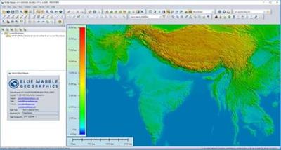
Global Mapper is an affordable and easy-to-use GIS application that offers access to an unparalleled variety of spatial datasets and provides just the right level of functionality to satisfy both experienced GIS professionals and beginning users.
A basic understanding of the key components of Global Mapper is an essential part any data processing or analysis workflow. In this hour-long presentation, we provide guidance and advice for new users of the software to help streamline and improve productivity. Starting with the installation and registration process, we introduce many of the important features and functions of the software including interface navigation; file, layer, and workspace management; data access and importing; feature creation and editing; and file exporting. The content of this presentation provides a solid foundation on which to successfully utilize the more powerful tools in the software.
Since the early 1990s, Blue Marble Geographics has been a pioneer in the development of powerful and innovative geospatial software. Widely regarded for its expertise in coordinate conversion and file format support, Blue Marble's products include Geographic Calculator, the paradigm for highly accurate spatial data conversion and advanced projection management; Global Mapper, a fully-functional and affordable GIS application; and the Global Mapper LiDAR Module, a suite of powerful point cloud processing tools.
Product: Global Mapper
Version: 21.1.0 (b021820)
Supported Architectures: x64
Website Home Page :
wwwbluemarblegeo.com
Language: english
System Requirements: PC *
Supported Operating Systems: *
Size: 455.3 mb
Global Mapper software is compatible with Windows 8/10 (32 and 64-bit versions), and Windows Server 2008 rc2/2012/2016/2019. The minimum system requirements are 4 GB of RAM and 500 MB of hard drive space for the installation.
download скачать LINKS :
https://nitroflare.com/view/0A84D57FA6B7505/mxone.eMaGloa210.x64.rar
https://nitroflare.com/view/87927B1D373E55F/mxone.eMaGloa210.x86.rar

https://uploadgig.com/file/download скачать/d211fff797d817B5/mxone.eMaGloa210.x64.rar
https://uploadgig.com/file/download скачать/ab24adC688e9C16c/mxone.eMaGloa210.x86.rar

https://rapidgator.net/file/fcf930da7ad84bf0a6adb40d37f9a304/mxone.eMaGloa210.x64.rar.html
https://rapidgator.net/file/313b4f7346f25c669e96cabbdc4ca05b/mxone.eMaGloa210.x86.rar.html