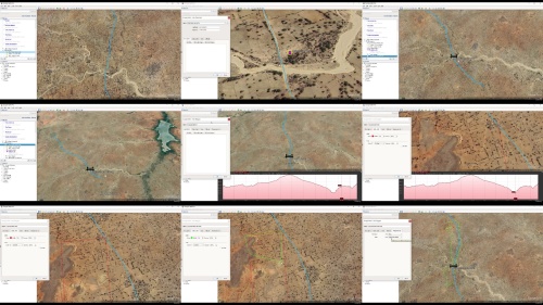
Google Earth Pro - Application to Engineering
Language: English | Size:5.8 GB
Genre:eLearning
Files Included :
1 Installation Guide download скачать and Installation.mp4 (37.34 MB)
MP4
2 Google Earth Pro Interface.mp4 (28.02 MB)
MP4
1 Search module.mp4 (108.45 MB)
MP4
2 Getting direction between two pointslocations.mp4 (132.28 MB)
MP4
3 Place module.mp4 (55.51 MB)
MP4
4 Side bar - Layers.mp4 (265.94 MB)
MP4
1 Navigation with mouse.mp4 (77.54 MB)
MP4
2 Navigation with google earth navigation bars.mp4 (154.16 MB)
MP4
3 Street view.mp4 (41.7 MB)
MP4
1 Explore the view menu.mp4 (195.17 MB)
MP4
2 Tools and Options.mp4 (126.7 MB)
MP4
1 Creating folder.mp4 (81.67 MB)
MP4
2 Adding placemark.mp4 (233.32 MB)
MP4
3 Add path.mp4 (242.03 MB)
MP4
4 Add polygon.mp4 (87.83 MB)
MP4
5 Add image (Image overlay).mp4 (203.76 MB)
MP4
6 Record a tour.mp4 (95.01 MB)
MP4
7 Historical imagery.mp4 (102.41 MB)
MP4
1 3D polygon.mp4 (66.85 MB)
MP4
2 3D path.mp4 (94.33 MB)
MP4
3 Creating a map.mp4 (252.5 MB)
MP4
4 Import EXCEL file to Google Earth Pro.mp4 (121.1 MB)
MP4
5 Import TXT file to Google Earth Pro.mp4 (56.74 MB)
MP4
6 Export Google Earth map and image to AutoCAD.mp4 (229.98 MB)
MP4
7 Extract editable AutoCAD objects from Google Earth Pro.mp4 (98.26 MB)
MP4
1 Place marking points.mp4 (81.73 MB)
MP4
2 Defining road profile.mp4 (76 MB)
MP4
3 Road profile analysis.mp4 (213.79 MB)
MP4
4 Extracting route survey data.mp4 (233.4 MB)
MP4
5 Extracting route survey data B.mp4 (189.1 MB)
MP4
6 Convert extracted data to CSV format.mp4 (74.52 MB)
MP4
7 Convert LAT & LONG to Easting and Northing.mp4 (91.25 MB)
MP4
8 Import Google Earth data to Design Software CivilCAD Civil3D.mp4 (82.31 MB)
MP4
9 Adding site image.mp4 (176.82 MB)
MP4
1 Determination of catchment area for bridge, culvert, dam etc.mp4 (368.49 MB)
MP4
2 Pipe Network - Setting reservoir location.mp4 (176.44 MB)
MP4
3 Pipe Network - Junctions and pipe line.mp4 (167.85 MB)
MP4
4 Establishing pipe layout.mp4 (118.33 MB)
MP4
5 Exporting pipe layout to EPANET as base file.mp4 (243.92 MB)
MP4
6 Loading pipe layout to EPANET as base file.mp4 (33.47 MB)
MP4
1 3D modeling of structure for Environmental Impact Analysis.mp4 (109.39 MB)
MP4
2 Determination of site altitude and closest distance to sea.mp4 (177.8 MB)
MP4
3 Grid survey.mp4 (133.63 MB)
MP4

Google Earth Pro - Application to Engineering.z01
https://rapidgator.net/file/a2e9ae56217fa20c6adbf8d7b68b3af2/Google_Earth_Pro_-_Application_to_Engineering.z01
Google Earth Pro - Application to Engineering.z02
https://rapidgator.net/file/90c1ecc1c1c103f3d02830764fe95218/Google_Earth_Pro_-_Application_to_Engineering.z02
Google Earth Pro - Application to Engineering.z03
https://rapidgator.net/file/34e076a9e6aa6749fadb9d52afa65ab7/Google_Earth_Pro_-_Application_to_Engineering.z03
Google Earth Pro - Application to Engineering.z04
https://rapidgator.net/file/77af1f38704f361cb087cc5c347c5687/Google_Earth_Pro_-_Application_to_Engineering.z04
Google Earth Pro - Application to Engineering.z05
https://rapidgator.net/file/fb43ab1fdbcfcfcd67816bdff4e0d17e/Google_Earth_Pro_-_Application_to_Engineering.z05
Google Earth Pro - Application to Engineering.zip
https://rapidgator.net/file/594bf7906e998298890bccbc77c706c0/Google_Earth_Pro_-_Application_to_Engineering.zip

Google Earth Pro - Application to Engineering.z01
https://alfafile.net/file/AuHS9/Google_Earth_Pro_-_Application_to_Engineering.z01
Google Earth Pro - Application to Engineering.z02
https://alfafile.net/file/AuHSr/Google_Earth_Pro_-_Application_to_Engineering.z02
Google Earth Pro - Application to Engineering.z03
https://alfafile.net/file/AuHSj/Google_Earth_Pro_-_Application_to_Engineering.z03
Google Earth Pro - Application to Engineering.z04
https://alfafile.net/file/AuHSm/Google_Earth_Pro_-_Application_to_Engineering.z04
Google Earth Pro - Application to Engineering.z05
https://alfafile.net/file/AuHSE/Google_Earth_Pro_-_Application_to_Engineering.z05
Google Earth Pro - Application to Engineering.zip
https://alfafile.net/file/AuHSy/Google_Earth_Pro_-_Application_to_Engineering.zip


